As he reported channel 24The system is fully automated using unmanned aerial vehicles (UAV).
how does everything work
Menatir is a network of base stations in the form of standard containers in which drones are placed. Containers protect aircraft, ensure their take-off, landing, mission performance, as well as the loading and transfer of data collected by them – and all this in automatic mode.
The monitoring system makes it possible to comprehensively monitor any object from the air in real time 24/7/365. Therefore, according to the developers, the system is perfect for services such as:
- firefighters,
- road tracks,
- environmental services,
- public services and infrastructure services.
Regardless of the number of base stations in the network, only one expert from anywhere in the world is needed to manage Menatir. Service and technical support is provided by the Culver Aviation team.
Our solution is unmatched in terms of automation and scalability. This is a new approach to working with UAVs and data. Businesses and government structures will be able to continuously receive and process information and make correct management decisions in automatic mode with minimal human involvement. 30% cheaper than traditional drones and helicopters with Menatir,
– says Oleksandr Danylenko, CEO of Culver Aviation and author of the project.
Self-developed UAVs and payloads
For the project, the company developed a unique Menatir UAV with vertical take-off and landing capability. With a single charge, an unmanned aircraft can fly up to 45 kilometers in one direction with the possibility of return.
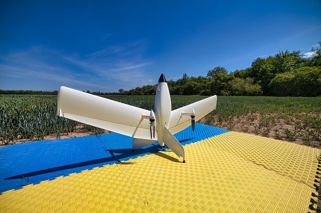
UAV for the Menatir system / Photo by Culver Aviation
The base station includes 6 such drones. One of the following types of payloads can be placed on the UAV:
Menatir can be used for video surveillance of any object in HD quality, aerial photography to create orthophoto plans of the area, monitoring the condition of crops, forests, bodies of water, preventing landscape fires, analyzing the state of air quality and other tasks. real-time according to a planned schedule or on request
Zoomable base stations
To cover large areas, the system can be scaled to any number of containers installed to overlap each other’s access zones. Drones will be able to move freely between network stations and will take no more than 20 minutes to fly to any of the coverage points. In the event of bad weather or force majeure in the area where one of the containers is located, the overlapping zones will allow another UAV to be lifted into the air and the mission to continue.
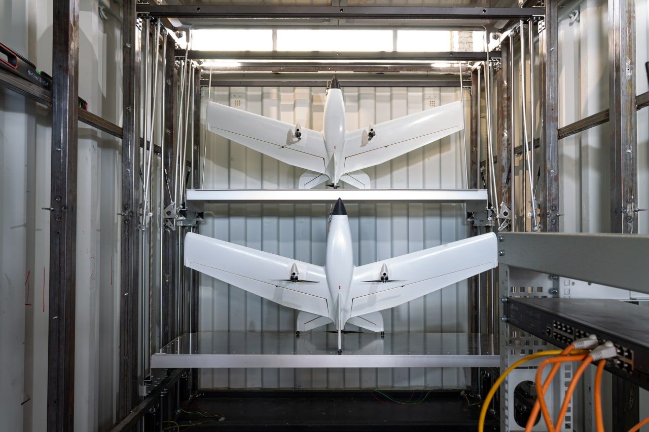
UAV inside the base station / Photo by Culver Aviation
Aircraft in automatic mode launch from the container, complete the mission and return according to the programmed missions. It takes 3 minutes from the receipt of the command to the departure of the aircraft. Each container has its own weather station that will protect the UAV: the system will stop the flight mission and in case of bad weather, the aircraft will return to the container.
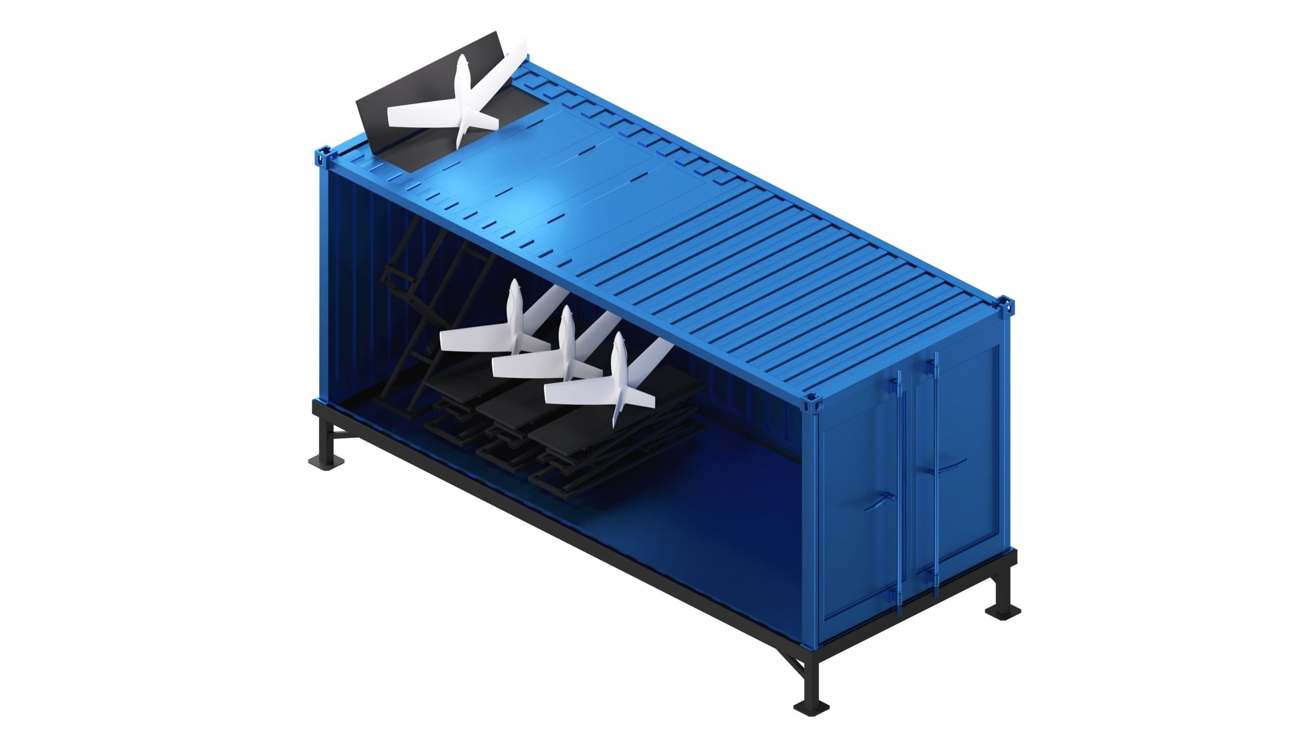
Location of the UAV in the container / Photo by Culver Aviation
The data collected by the drones is processed and analyzed by a special software with the Drone Management System, which is artificial intelligence elements. The system sends the execution phases and results of flight missions to network users, specifically via a mobile application.


