Google, after the Kremlin invasion of Ukraine, from Russian users ads forbidden; Russian authorities accused Google of starting an “information war” when the company blocked Russian media on YouTube. After the tension between Russia and Google, the US-based tech giant today a new move came.
According to new information, Google Maps shows Russia’s strategic military facilities. visible to users created. After this move, new details about Russia’s military infrastructure emerged.
Google Maps makes Russia’s strategic military areas visible
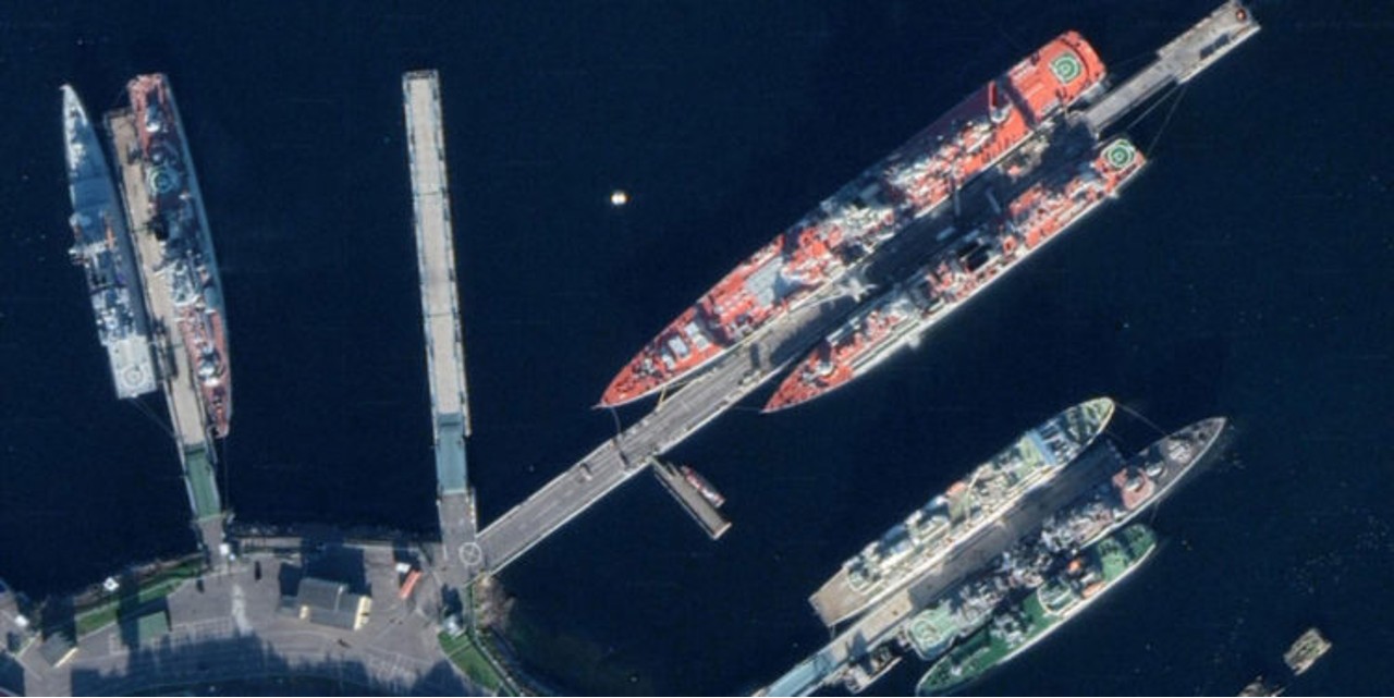
Images of military bases, intercontinental ballistic missile launch pads, naval facilities and key command posts across Russia in Google Maps searches available has become. Some of the new images that have surfaced include Admiral Kuznetsov’s aircraft carrier, a nuclear weapons depot near Murmansk, submarines on the Kamchatka Peninsula in the Far East, and a military airbase in the western city of Kursk, just 150 kilometers from the Russian border. and Ukraine.
Under normal circumstances, satellite images of military installations are traditionally scanned by Google Maps to maintain their classified status. blurred or lower quality offered to users. However, with this move from the Google wing, this situation has changed.
In the post on Twitter of the Ukrainian Armed Forces, “Now everyone is using Russian military infrastructure that costs about a pixel per pixel. with a resolution of 0.5 meters can see” statements were included.


