Satellite now continuously monitors lightning in Europe
July 17, 2023
0
Satellites often open up new perspectives at launch. Sometimes because of their placement, sometimes because of their equipment. A new satellite created by a consortium of European companies
Satellites often open up new perspectives at launch. Sometimes because of their placement, sometimes because of their equipment. A new satellite created by a consortium of European companies and agencies now offers a new perspective on one of the most powerful and transient natural phenomena, lightning.
The third-generation Meteostat (MTG) satellite was launched in December and actually includes not one but two new imaging devices. The flexible imaging camera does a great job of producing crystal clear images that can be combined into some impressive videos, the first of which was released in April.
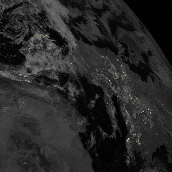
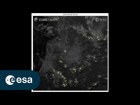
Recently, however, a team from ESA and the European Meteorological Satellites Exploitation Organization (Eumetsat) released a series of images from another MTG sensor, the Lighting Imager. The results include stunning photos in a frame, which are then combined into an even more stunning video.
The camera itself consists of four different cameras. Together, they cover parts of Europe, Africa, the Middle East and South America from an altitude of about 36,000 km. Simonetta Cheli, direct manager of ESA’s Earth observation programs, states that it covers more than 84% of the Earth’s disk, at least on the side it’s looking at. Each camera also takes 1,000 images per second, allowing them to see even the shortest lightning flashes.
This also results in large amounts of data, so MTG does most of the image processing locally and only sends the relevant bits back to Earth. The algorithm that does this, together with the thermal camera, was developed by the Italian company Leonardo Space, which specializes in the development of satellite devices.
The real magic happens when MTG combines the data from the Lightning image into a flexible composite image. With these two powerful tools you can create truly dramatic shots. But the data, besides being just fun to look at, can be used for both scientific and meteorological purposes. Tracking storms and alerting areas that may be at risk of severe weather are now much easier. Over time, these weather patterns will also become clearer, allowing meteorologists to more accurately predict the development of storm fronts.
But for now, this is just the beginning of MTG’s journey. Despite the release of these impressive images, it is still technically in the commissioning phase. It plans to be fully operational in early 2024. And even more impressively, it plans to work for more than 20 years, providing information on severe storms and weather conditions.
During this time, it will merge with other weather satellites and other sensing systems, some of which will use infrared sounders and UV-visible near-infrared spectrometry, providing even newer perspectives for both everyday assessment and science. Source
As an experienced journalist and author, Mary has been reporting on the latest news and trends for over 5 years. With a passion for uncovering the stories behind the headlines, Mary has earned a reputation as a trusted voice in the world of journalism. Her writing style is insightful, engaging and thought-provoking, as she takes a deep dive into the most pressing issues of our time.