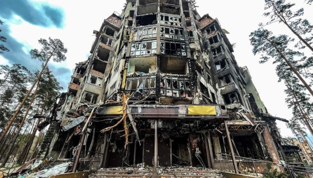
In some settlements in the Kyiv region, part of the material has already been filmed as part of a joint project of experts from the Ministry of Internal Affairs and Google to digitize the consequences of the Russian invasion.
This was announced by the Deputy Minister of Internal Affairs of Ukraine, Ihor Bondarenko, at a briefing held at the Ukraine-Ukrinform media center.
“Now the closest cities to Kiev are: Irpin, Bucha, Gostomel, Stoyanka, Gorenka – we have already pulled some of the materials there … And now we are working on scaling this business, because unfortunately we need volumes Sumy and Chernihiv oblasts this work now where it is possible to execute. be ready for them, ”said Bondarenko.
He noted that panoramas of destroyed houses, roads and infrastructure can be viewed on Google maps.
According to him, the project will be open to the public for those who want to have objective data about its region and real estate. It is planned to create a separate service for law enforcement and rescue teams, which can use it as a source of information and references to coordinate their actions and further record the situation in the area.
As Ukrinform reported, in early April, the Ministry of Internal Affairs reported that the Ministry of Internal Affairs, together with Google experts, launched a project to digitize the results of the Russian occupation in the destroyed cities of Ukraine.


