“Prytula Satellite”: opportunities, advantages and practical application for the Armed Forces
August 18, 2022
0
I’ve read that the Serhiy Prytula Foundation has access to the full capabilities of one of ICEYE’s satellites. I had to look for information about what kind of
I’ve read that the Serhiy Prytula Foundation has access to the full capabilities of one of ICEYE’s satellites.
I had to look for information about what kind of company it is and what the capabilities of its satellites are.
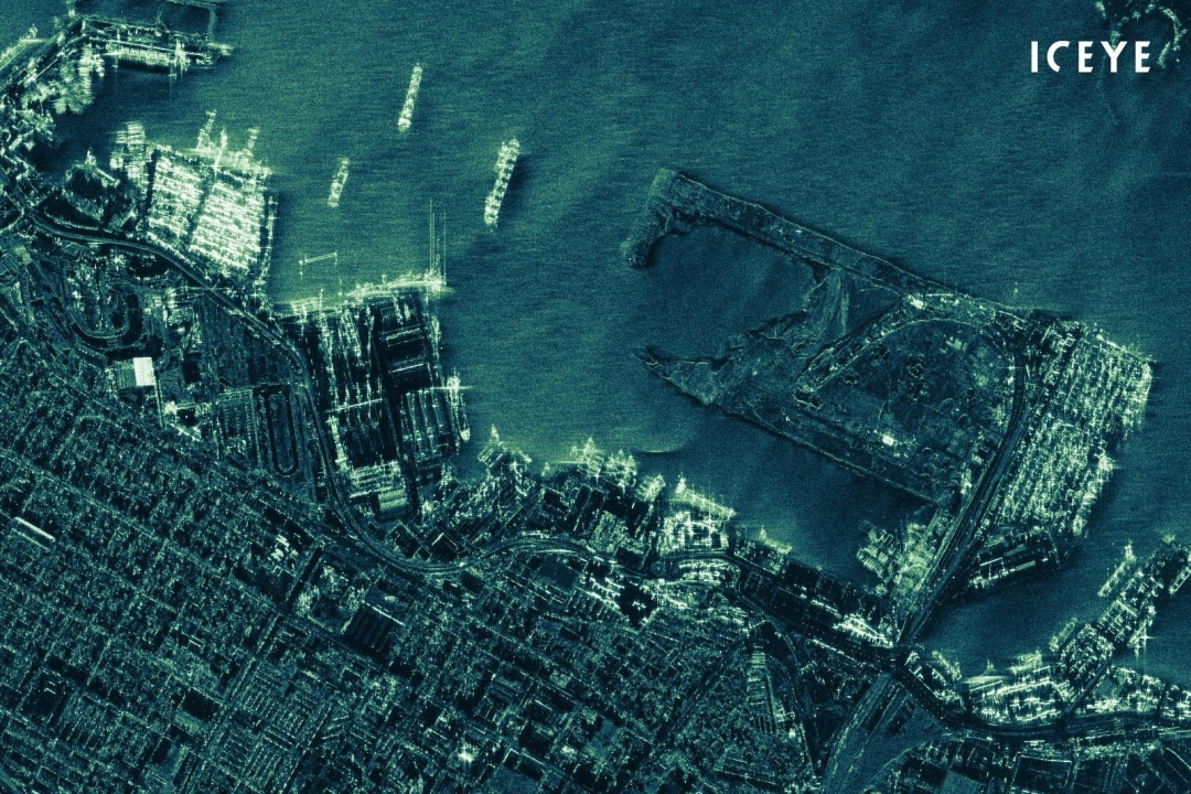
ICEYE is a Finnish company founded in 2014. In 2018, they launched the first sub-100kg synthetic aperture radar satellite and Finland’s first commercial satellite, ICEYE-X1.
In October 2019, ICEYE began offering commercial access to 1-meter SAR images. In January 2022, there were already 16 satellites in orbit.
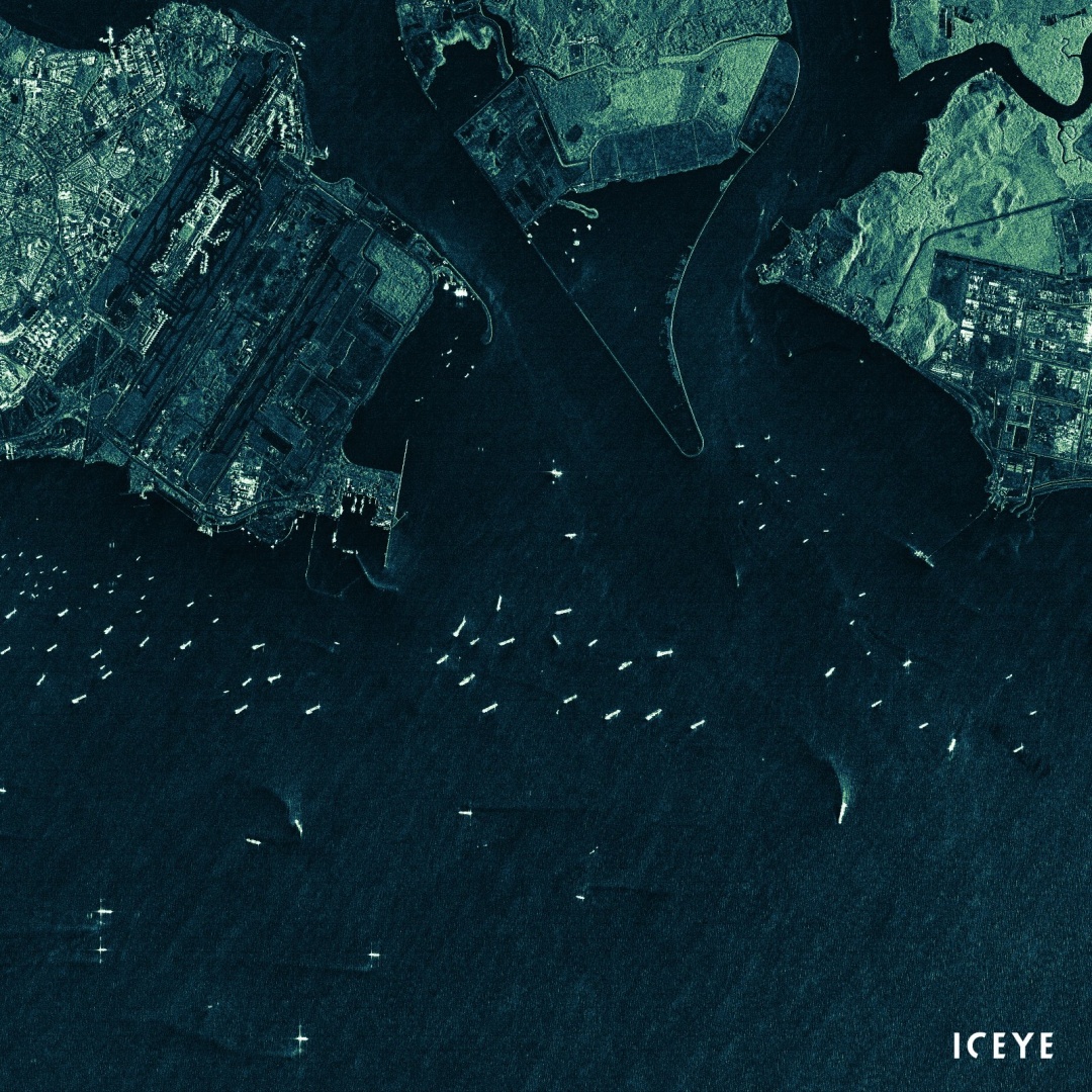
SAR (Synthesized Aperture Radar) technology is superior to optical devices in that it allows you to obtain quality images at all times and in all weather conditions, even in dark and cloudy weather. Additional benefits include the high frequency and timeliness of satellite image acquisition, ideal for object detection, target tracking, activity tracking and more.
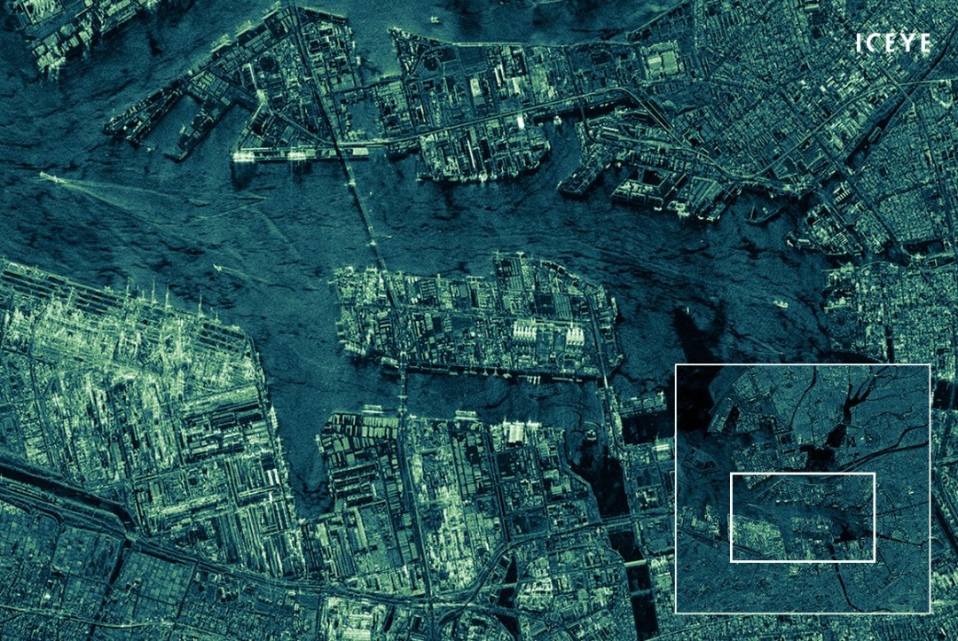
To obtain a SAR image, the radar transmits successive pulses of radio waves to “illuminate” the target object, and the return echo from each pulse is recorded. Pulses are transmitted and received by a single spatially filtered antenna, with wavelengths from meters to millimeters used throughout space.
As the satellite is in orbit, the position of the antenna relative to the target changes over time. Using the algorithm to process the recorded radar signal, you can combine data from several antenna positions. This allows you to create a synthesized aperture and generate higher resolution images than is possible with the given physical characteristics of the antenna aperture.
ICEYE now provides access to entirely new levels of data for continuous monitoring of areas large and small worldwide, in all weather conditions, every few hours, day or night. From tracking fast moving objects like ships at sea to monitoring and resolving national security issues.
The practical application for the Armed Forces, in my opinion, is that it is possible to track the movement of enemy troops with high relevance and resolution day and night, regardless of the weather. Hopefully we’ll see images from this satellite soon.
Vitaly Trubnikov
Facebook
* The author’s point of view may not coincide with the agency’s position.
I’m Maurice Knox, a professional news writer with a focus on science. I work for Div Bracket. My articles cover everything from the latest scientific breakthroughs to advances in technology and medicine. I have a passion for understanding the world around us and helping people stay informed about important developments in science and beyond.


:quality(85)//cloudfront-us-east-1.images.arcpublishing.com/infobae/42SAZRW34RCKFEFKJBBCPSUT3Q.jpg "Meta has 6 features for Reels on Instagram and Facebook")


