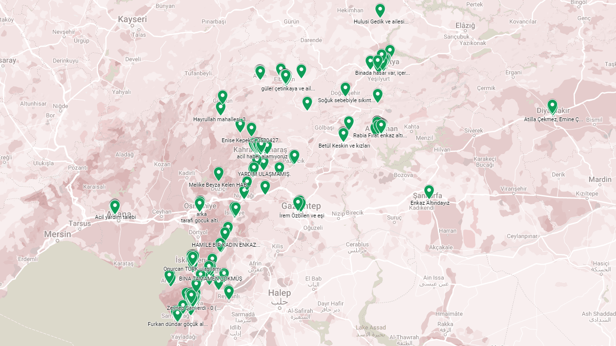
Our country has been affected and already more than 15 million After the disasters of February 6, when the victimization was experienced, all possibilities turned to rescue.
Undoubtedly, the most necessary of these opportunities is for the victims. uninterrupted internet and telephone traffic stock. This is where satellites come into play.
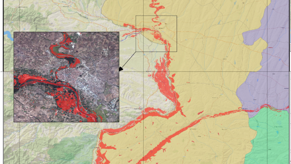
Satellites can be used at the request of states, especially after major disasters such as earthquakes. In this way, it is possible to examine the areas affected by disasters in detail by using images such as the images below of the Edirne flood area in 2015.
Satellites that have fundamentally changed our daily lives in the short term, to summarize, starting with the launch of Sputnik-1 into orbit. A product of the Space Race and one of the most important inventions in human history.
Its main task is between different points of the earth. provide direct communication Satellites are now a technology that all people can benefit from thanks to their mobile phones, even in difficult days.
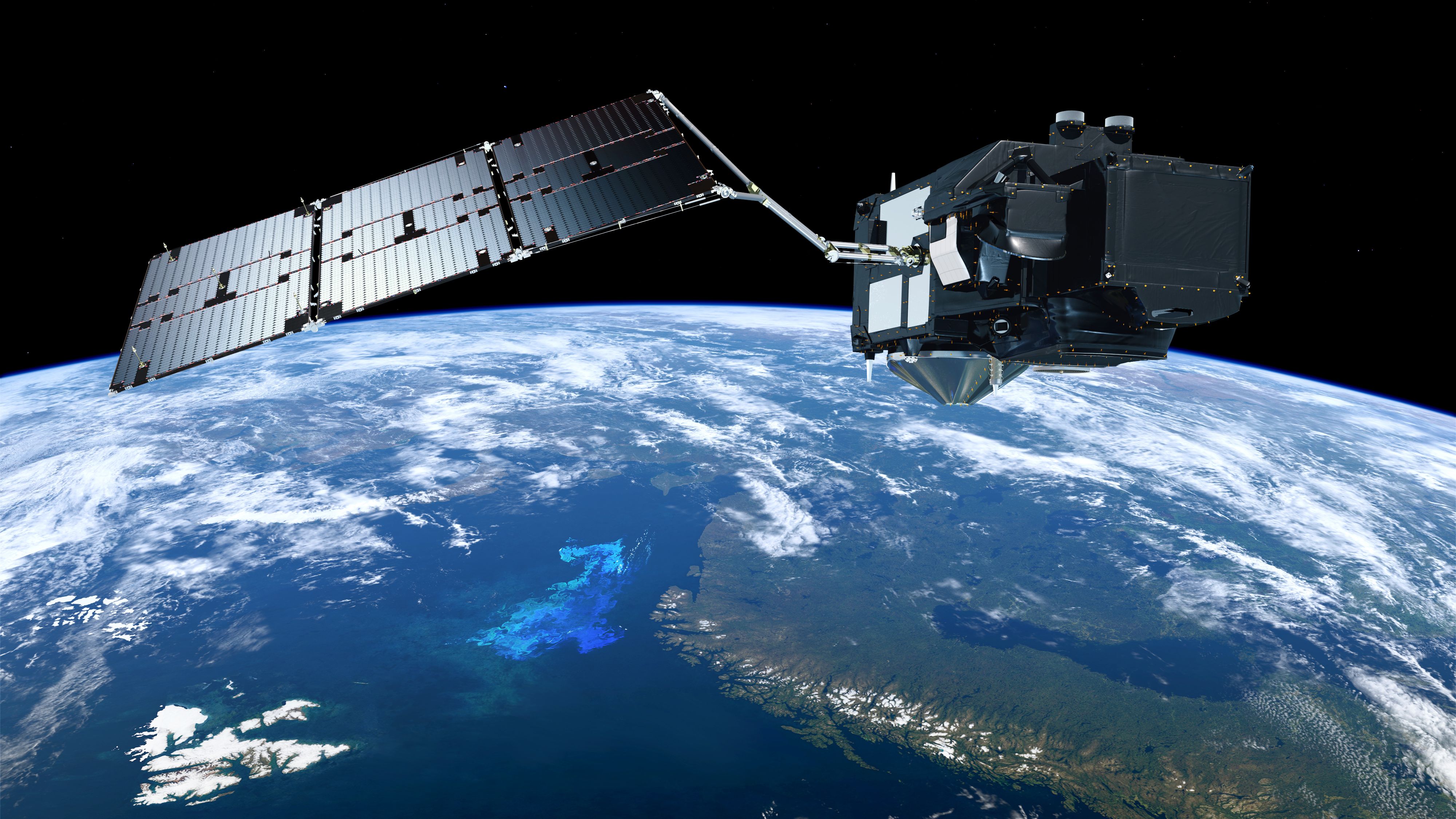
Monitoring of natural disasters and their damage, including earthquakes, thanks to satellites., trying to anticipate possible disasters to take precautions and victims of natural disasters to communicate directly possible.
AFAD has taken advantage of satellites many times to this day under projects such as the “Post-Disaster Snapshot Transfer Project”. According to AFAD, this project consists of three modules:
- Snapshot transfer systems: The resulting images are transferred to ground stations.
- Components for communication via satellite infrastructure: Acquired images pass back and forth between ground stations and AFAD and communication is established.
- Direct projection of video images on two- and three-dimensional maps: The resulting images are projected onto two- and three-dimensional maps to measure the extent and damage of the disaster.
AFAD’s preferred technologies use “AYDES – UZAL” and “AYDES – Crowdsource” software, as well as electro-optical satellite technology, aerial photography technologies, synthetic aperture radar (SAR), object-based image analysis and texture analysis algorithms and software, facilitates disaster recovery efforts.
The European Union, which has activated its satellites from day one through the Copernicus program and has prepared a search and rescue team of 1155 people in a short time, is directing satellite support to Turkey from abroad.
On the morning of February 6, not only Turkey, but the whole world, including our European neighbors, woke up to a tragic day. At 07:04, AFAD announced that the United Nations has so far activated 797 times in 154 countries. Activation of the “Space and major disasters” regulation. At his request, the button was pushed for international aid purchases to Turkey. This call for help included the request to mobilize as many satellites as possible for Turkey in the international arena.
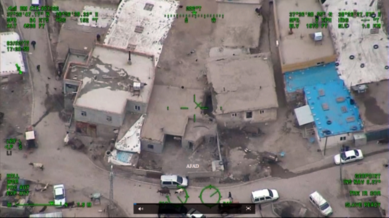
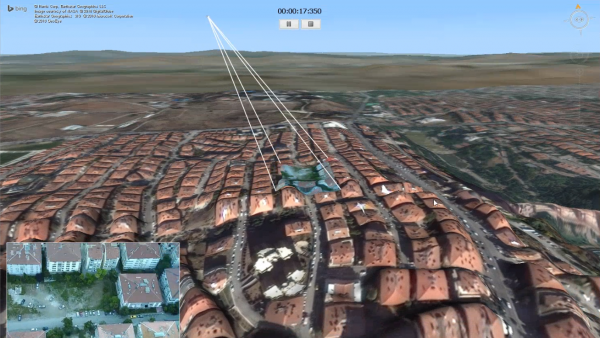
- Image: After the magnitude 5.5 earthquake that occurred in Adıyaman Samsat on March 2, 2017, the video images of the disaster area were transmitted in real time to the crisis center and analyzed.
This regulation allows satellites to be activated at the request of a state in the event of major disasters such as the February 8 earthquakes. Austria, Bulgaria, Croatia, Czech Republic, Estonia, France, Greece, Hungary, Italy, Malta, Netherlands, Poland, Romania, Slovakia, Spain, Portugal, Germany, Albania and Montenegro in response to Turkey’s appeal for help A rescue team of 1155 people They created and depended on the Copernicus program of the European Space Agency. mobilized their satellites.
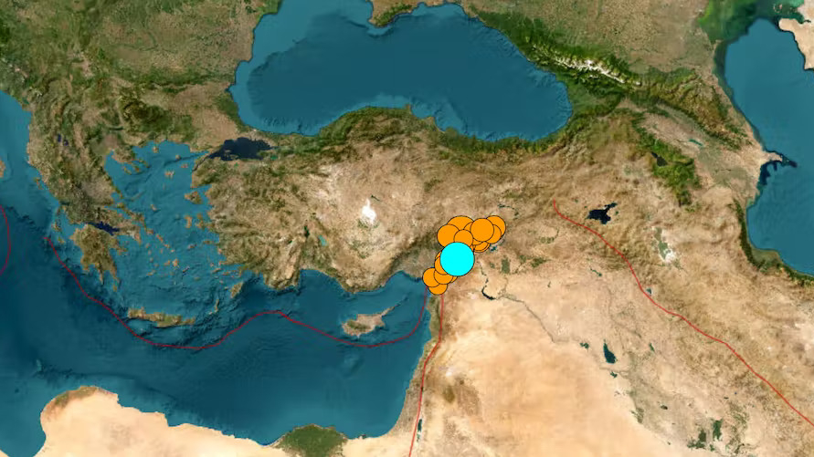
As you can imagine, AFAD had already passed on the location information these teams would need in the call for help. Thanks to this location information and the additional details needed, especially satellites such as GOCE, the European Space Agency’s (ESA) seismograph satellite, where was damaged And where the most urgent interventions are needed It can analyze it in detail and forward it to all rescue teams. Thanks to such satellites, of which an average of 60 can be used simultaneously, millions of lives have been saved after natural disasters.
So how can we use satellites to support rescue efforts?
the internet itself And all the devices we use, somehow they work thanks to satellites. That is why we actively use satellites on a daily basis. Of course, while we’re getting all these additional satellite capabilities, it’s possible for us to use them to support search and rescue.
- Sources: European Commission, The Conversation, AFAD


